Your behavior appears to be a little unusual. Please verify that you are not a bot.


TAG: point cloud

GIS helps archaeologists trace a mother’s journey

November 24, 2021By
White Sands has the largest collection of fossilized human footprints. (Photo: National Park Service)

“The tasks of paleontologists and classical historians and archaeologists are remarkably similar — to excavate, decipher and bring to life the tantalizing remnants of a time we will never see.” — Adrienne Mayor Heatwaves rose up from the dusty, dry, cracked ground. Tiny black flies buzzed around the team’s eyes and faces. The only shade was under a canopy erected... read more

3 keys to successful canopy penetration

August 26, 2020By
Photo: RedTail

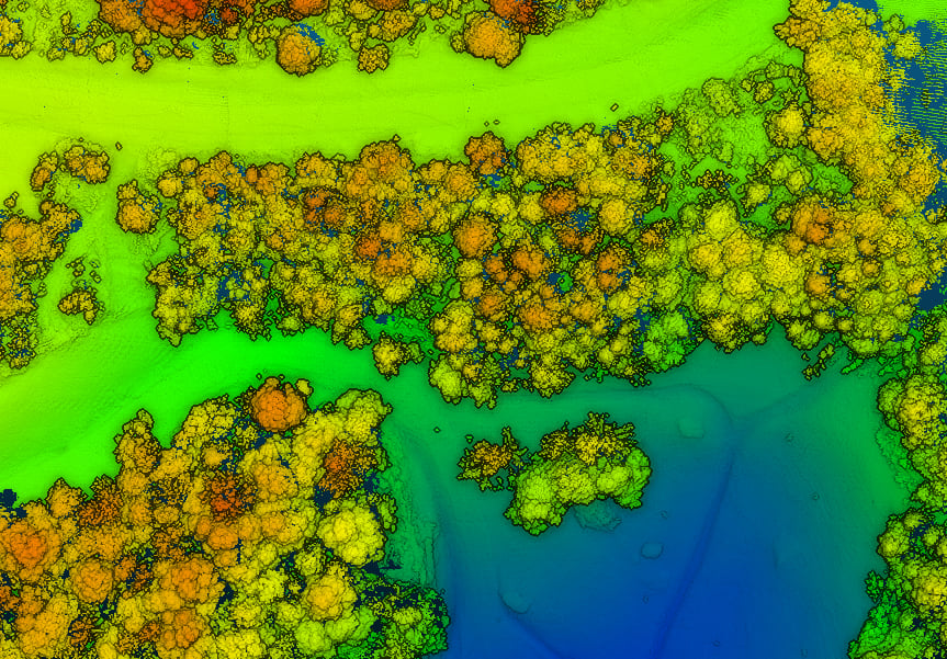
RedTail Lidar System’s RTL-400 delivers the trifecta Summer is here, and with it comes the challenge of creating accurate topographic maps under tree canopies. The adoption of drone-based, 3D light detection and ranging — or lidar — is emerging as the go-to sensing technique to meet this challenge consistently, safely and cost effectively. Designed specifically for use on small drones,... read more

The value of point clouds is unlimited

August 25, 2020By
Image: OxTS

By Jacob Amacker Oxford Technical Solutions What is a point cloud? A point cloud is fundamentally a simple construct. It is a collection of points in 3D space, each point being given a coordinate in Cartesian convention. The points can also be given other properties, often these will be indicative of how they were obtained. Examples might include the time... read more

NavVis IndoorViewer 2.6 enables measurement based on point clouds

April 7, 2020By
Logo: NavVis

Enables building stakeholders to take accurate measurements based on point clouds The latest release of the NavVis IndoorViewer 3D building visualization software features a new tool that lets building stakeholders take highly accurate measurements based on point clouds in the realistic 360° image view. NavVis, global provider of indoor spatial intelligence technology and enterprise solutions, announces the release of NavVis IndoorViewer... read more

SimActive launches free data-processing service using Correlator3D

March 16, 2018By

SimActive Inc., a developer of photogrammetry software, is offering a new free data-processing service using Correlator3D. New users can upload their first UAV, satellite or aerial image project to obtain digital surface model (DSM), digital terrain model (DTM), point cloud and orthomosaic outputs. Along with optimal results, users also receive tailored feedback, recommendations and training from SimActive experts. The service requires... read more

Viametris mobile backpack scanner includes panoramic camera

March 16, 2018By

Mobile-scanning company Viametris has launched the bMS3D backpack mobile scanning system, which features an embedded 360° camera. Narrow streets and pedestrian zones are considered hurdles when it comes to mobile scanning. The new bMS3D-360 makes these tasks achievable. It is now available on the market and it comes with post-processing software. It will be presented at SPAR 3D 2018 in June. “Users of... read more

LizardTech granted US patent for lidar point-cloud compression

September 22, 2017By

LizardTech, a provider of software solutions for managing and distributing geospatial content, has been awarded a U.S. patent for the compression of lidar point clouds (US 9753124). The patented technology provides lossless compression of point clouds captured by airborne lidar sensors or terrestrial laser scanners for easy and cost-effective processing, storage and transmission of data sets. “Lidar systems capture terabytes... read more

ISPRS Geospatial Week

September 28, 2015By

The 2015 ISPRS Geospatial Week will take place from Sept. 28 to Oct. 2 at the Conference Center La Grande Motte in France. The ISPRS Geospatial week 2015 is a scientific event hosting a bundle of high quality conferences and workshops on the topics of geospatial data acquisition, data processing, data visualization and dissemination. These conferences can be native ISPRS... read more

This article is tagged with , , , and posted in

Trimble Expands Geospatial Portfolio to Increase Productivity

April 24, 2015By

  Trimble has expanded its portfolio of geospatial solutions for surveyors, engineers and mapping professionals. Highlights include new total stations, a new GNSS receiver and new field and office software features. The solutions save time, reduce costs, streamline workflows and produce high-quality geospatial deliverables across a wide range of industries, Trimble said. “Trimble’s portfolio expansion will enable our customers to... read more

Arithmetica to Launch Pointfuse Modeling Engine at Intergeo

October 7, 2013By

Arithmetica will be demonstrating Pointfuse at Intergeo, which is being held this week in Essen, Germany. Pointfuse is a powerful modeling engine that has been created to give professionals a fast, precise and flexible way of turning vast point cloud data sets (whether derived from LIDAR or photogrammetry) into high-fidelity vector models, the company said. Replacing painstaking and costly manual... read more