TDC and Freeance field apps join with Trimble GIS
June 9, 2020
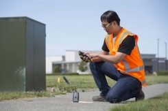
TDC’s Freeance field applications leverages Trimble GNSS for accurate, streamlined data collection TDC Group has joined Trimble’s GIS […]
Read More
TDC’s Freeance field applications leverages Trimble GNSS for accurate, streamlined data collection TDC Group has joined Trimble’s GIS […]
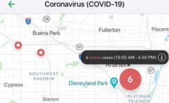
Vesedia Mobile Technologies is offering to deploy its location platform to help control the COVID-19 pandemic through tracking […]

A team of medical researchers and bioethicists at Oxford University published results in Science that offer further understanding […]

The European GNSS Agency, based in Prague, is providing on its website a list of location-enabled applications that […]

News from the European GNSS Agency The winners of this year’s MyGalileoApp competition were announced at a ceremony […]

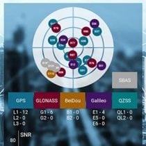
The award for “Energizing the Market with a Bundle” recognizes Eos’ seamless integration of its Arrow Series GNSS […]
SXblue, also known as Geneq, has introduced its SXblue ToolBox, an Android application for SXblue GNSS receivers. Using the […]
Avenza Maps 3.4 for iOS and Android is now available. It contains new features and performance improvements, including […]


Follow Us