Trimble joins with Exyn on autonomous surveying solution
November 7, 2022
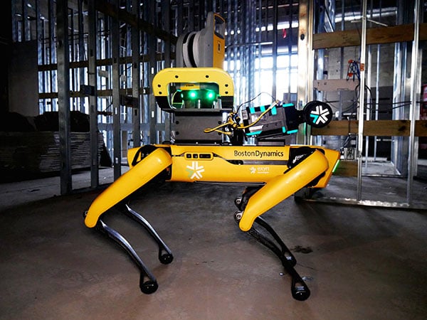
Trimble and Exyn Technologies are working on a proof of concept for a fully autonomous surveying solution for […]
Read More
Trimble and Exyn Technologies are working on a proof of concept for a fully autonomous surveying solution for […]

This year, INTERGEO placed a focus on digital twins. Cooperation, collaboration and the sharing of information are crucial for the success of the digitalization of city, country and space.

Hexagon AB, which offers digital-reality solutions combining sensor, software and autonomous technologies, will integrate AVVIR’s artificial-intelligence-powered technology stack […]
The INTERGEO Expo & Conference focuses on innovations for a smarter world. INTERGEO 2022 will take place October 18-20 in Essen, Germany.

Cesium’s 3D technology will power smart construction dashboard to make construction safer, more efficient and more profitable Komatsu […]

As we close the book on 2019 and head into the next decade, much has changed during the […]
The development of augmented reality as a tool to manage and visualize hidden infrastructure assets has taken a […]

Topcon Positioning Group released a new strategy through its Topcon Solutions Store retail channel. Together with Autodesk, and as […]


Follow Us