Next 10 years of EGNOS to focus on drones
March 30, 2021
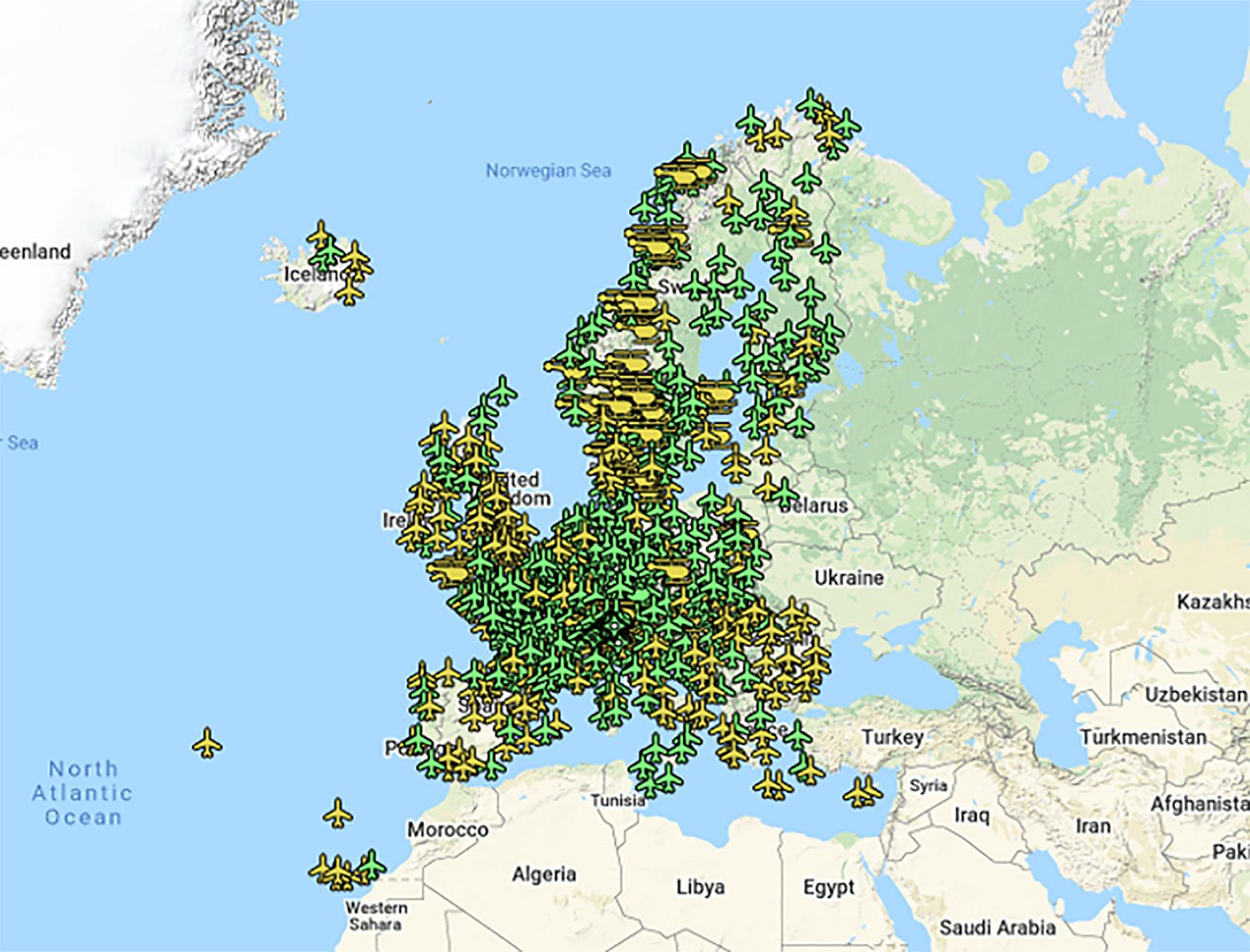
Europe’s EGNOS satnav system has been providing safety-of-life services for 10 years. EGNOS, the European Geostationary Navigation Overlay Service, […]
Read More
Europe’s EGNOS satnav system has been providing safety-of-life services for 10 years. EGNOS, the European Geostationary Navigation Overlay Service, […]

Oxford Technical Solutions has released the xNAV650, the latest in its line of inertial navigation systems (INS), suitable […]

A roundup of recent products in the GNSS and inertial positioning industry from the January 2021 issue of […]
Advancements in sensors, cameras and automation have fueled the growth of the aerial imaging industry, which is expected […]

NXP and Auterion join forces to enable next-generation secure drone fleets with automotive certified solutions, high-reliability networking, and […]

A free, full-day workshop, titled “Cognizant Autonomous Systems for Safety Critical Applications (CASSCA),” will be held Jan. 29, […]

U-blox has launched a new positioning module, the ZOE-M8G. The ZOE-M8G is an ultra-compact GNSS receiver module designed for […]

Lockheed Martin and the Warsaw University of Technology (WUT) successfully demonstrated their UAV optimization technologies using aerial command […]


Follow Us