Bringing 3D perception beyond autonomous vehicles
April 4, 2022
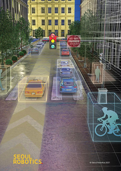
Predictions for the next big industries in lidar By HanBin Lee CEO, Seoul Robotics Lidar sensors that used […]
Read More
Predictions for the next big industries in lidar By HanBin Lee CEO, Seoul Robotics Lidar sensors that used […]

“The tasks of paleontologists and classical historians and archaeologists are remarkably similar — to excavate, decipher and bring […]

GPS and airborne light detection and ranging (lidar) have revolutionized archaeology. In just a little more than a […]

Under a new agreement, Lidar USA — a developer of geomatics solutions — will include Hesai Technology Co. […]

New flagship offering can be mounted on a light manned aircraft or switched to different types of UAV […]
Velodyne Lidar will display its lidar sensors and software at the IAA Mobility trade show, which takes place […]

NV5 Geospatial debuts predictive modeling platform to improve utilities’ vegetation management programs NV5 Geospatial has launched Trim Optimization, […]

AsteRx SBi3 enables highly accurate and reliable 3D mapping solutions based on sensor fusion with lidar Septentrio, a […]


Follow Us