
Launchpad: New antennas, scanners and survey applications
June 26, 2023
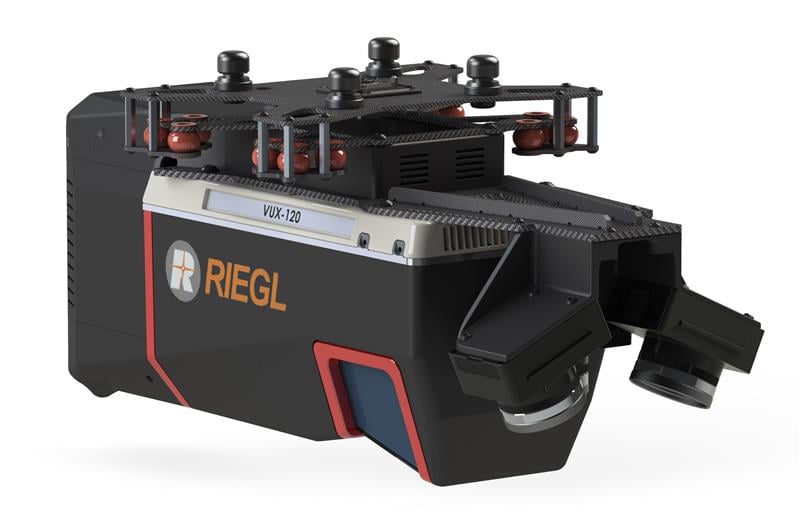
A roundup of recent products in the GNSS and inertial positioning industry from the May 2023 issue of GPS World magazine.
Read More
A roundup of recent products in the GNSS and inertial positioning industry from the May 2023 issue of GPS World magazine.

Leica Geosystems, part of Hexagon, has released the Leica CountryMapper for large-area imaging and lidar mapping.
A roundup of recent products in the GNSS and inertial positioning industry from the March 2023 issue of GPS World magazine.
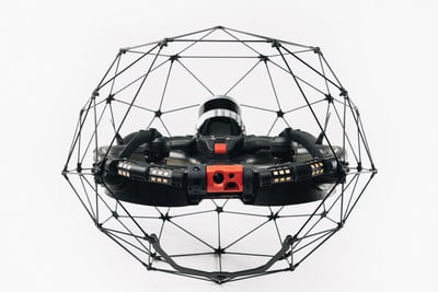
Flyability has unveiled the Elios 3, a collision-tolerant drone equipped with a lidar sensor for indoor 3D mapping. […]

The collection of about 300 giant geoglyphs known as Nasca Lines were etched into the ground in the […]

Teledyne Optech’s new compact lidar sensor, the CL-90, is available for purchase through its first integration partnership with Lidar […]

Velodyne Lidar Inc., maker of 3D vision systems for autonomous vehicles, is partnering with YellowScan to integrate its […]
Teledyne Optech‘s ALTM Titan lidar sensor earned the 2015 Grand Award in the ninth annual MAPPS Geospatial Products and Services […]


Follow Us