
IPIN 2023 paper submissions now open
February 15, 2023
Fraunhofer IIS has opened paper submissions for The International Conference on Indoor Positioning and Indoor Navigation (IPIN) 2023.
Read More
Fraunhofer IIS has opened paper submissions for The International Conference on Indoor Positioning and Indoor Navigation (IPIN) 2023.
“Seen & Heard” is a monthly feature of GPS World magazine, traveling the world to capture interesting and […]
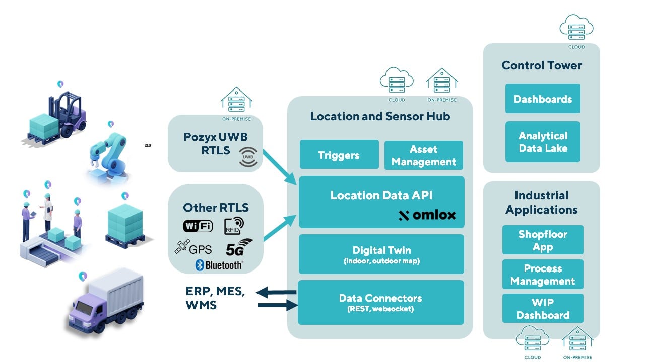
The Pozyx Platform is an asset tracking and identification solution for seamless indoor and outdoor tracking, based on […]

A “BeiDou positioning system for subways” began construction March 20 on the Beijing subway capital airport express line. […]

A roundup of recent products in the GNSS and inertial positioning industry from the February 2022 issue of GPS World magazine.
Esri has released ArcGIS IPS, an indoor positioning system. ArcGIS IPS adds a blue dot to indoor maps, […]
Dublin-based danalto Ltd., has won a contract with the European Space Agency (ESA) to demonstrate low-infrastructure indoor location […]

u-blox’s Bluetooth low-energy module features direction finding, bringing the benefits of high-precision positioning to indoor applications U-blox, provider […]


Follow Us