L3Harris explains how ENVI is used for disaster response at Esri UC 2019
-


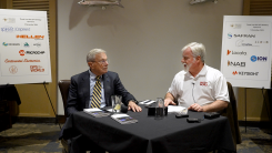
At the Esri 2019 User Conference, L3Harris’ Zachary Norman discusses how the company’s ENVI® (Environment for Visualizing Images) image analysis software, combined with deep learning, help with disaster response. Norman covers two scenarios where the technology can be used: flooding and forest fires, including the California Camp Fire in November 2018.


About the Author: Allison Kral
Allison Kral is the former digital media manager for North Coast Media (NCM). She completed her undergraduate degree at Ohio University where she received a Bachelor of Science in magazine journalism from the E.W. Scripps School of Journalism. She works across a number of digital platforms, which include creating e-newsletters, writing articles and posting across social media sites. She also creates content for NCM's Pit & Quarry magazine, Portable Plants magazine and Geospatial Solutions. Her understanding of the ever-changing digital media world allows her to quickly grasp what a target audience desires and create content that is appealing and relevant for any client across any platform.


Subscribe to GPS World
If you enjoyed this article, subscribe to GPS World to receive more articles just like it.


Follow Us